Great Lakes and Rivers Civ5 map and scenario Introduction:
Greak Lakes Civ5 map and scenario is based on a detailed map of the Great Lakes region between the United States and Canada, featuring the true locations of major cities around Lakes Superior, Michigan, Huron, Erie, and Ontario. The geography reflects the real terrain of the area, including lakes, rivers, and surrounding landscapes.
You will start the game near the beginning of history, in 3500 BC during the Classical Era, with one state already established. Your civilization begins with 4–6 cities, where the capital starts at level 2 and the remaining cities at level 1. The rest of the map is already revealed, allowing you to see neighboring territories and plan your strategy from the start.
Control of the Great Lakes region and its resources will be key to your success.

Scenario is based on real map of area
Why play this map? Key features:
- Real location of cities
- Real states and their boundaries
- Big Rivers (Ohio, Mississippi, Missouri, St.Lawrence, Hudson, Illinois) are navigable for all ships. Also all Lakes are navigable.
- Natural wonders are placed randomly.
- Strategic and luxury resources according reality
- Two versions of scenario (First only with cities, second with real states boundaries) + one empty map
Playable civs:
Quebec (France) represented by 5 cities (Montreal, Trois Rivieres, Quebec, Rimouski and Seguneay ) on St.Lawrence River
Ontario (Shoshone) represented by 6 cities (Toronto, Belleville, Kingston, Ottawa, Kitchener, Thunder Bay) on the north side of 3 lakes (mostly Lake Ontario)
New York (Iroquois) represented by 6 cities (Buffalo, Rochester, Syracuse, Binghampton, Albany, New York,) on the south side of Lake Ontario and near Hudson river
New England (Celtics) represented by 5 cities (Boston, Rochester, Portland, Providence, Hartford) on the east coast near Atlantic Ocean
Michigan (Gemany) represented by 6 cities (Detroit, Flint, Grand Rapids, Lansing, Traverse City, Marquette) between lakes Michigan and Huron.
Pennsylvania (Dutch) represented by 5 cities (Philadelphia, Harrisburg, Wilkes-Barre, Pittsburgh, Erie) between Erie Lake and Atlantic ocean.
Wisconsin (Sweden) represented by 5 cities (Milwaukee, Green Bay, Madison, Eau Claire, Oshkosh) from the Lake Michgan to Lake Superior.
Ohio (England) represented by 5 cities (Toledo, Cleveland, Columbus, Dayton, Cincinnati) from the Lake Erie to Ohio river.
Illinois (America) represented by 4 cities (Chicago, Rockford, Peoria, Springfield) from Michigan Lake to Mississippi river.
Missouri (Egypt) represented by 4 cities (St.Louis, Kansas City, Columbia, Springfield) along Mississippi and Missouri river.
Minessota (Denmark) represented by 4 cities (St.Paul, Minneapolis, Duluth, Rochester) from Mississippi river to Lake Superior.
6 City states
Virginia (Richmond, Washington), West Virginia (Charleston), Kentucky (Louisville, Lexington), Indiana (Fort Wayne, Indianapolis), Iowa (Cedar Rapids, Des Moines) and Sault Ste Marie
Screenshots:

St. Lawrence River near Quebec
New England North part of Lake Ontario:
 Lake Ontario and New York
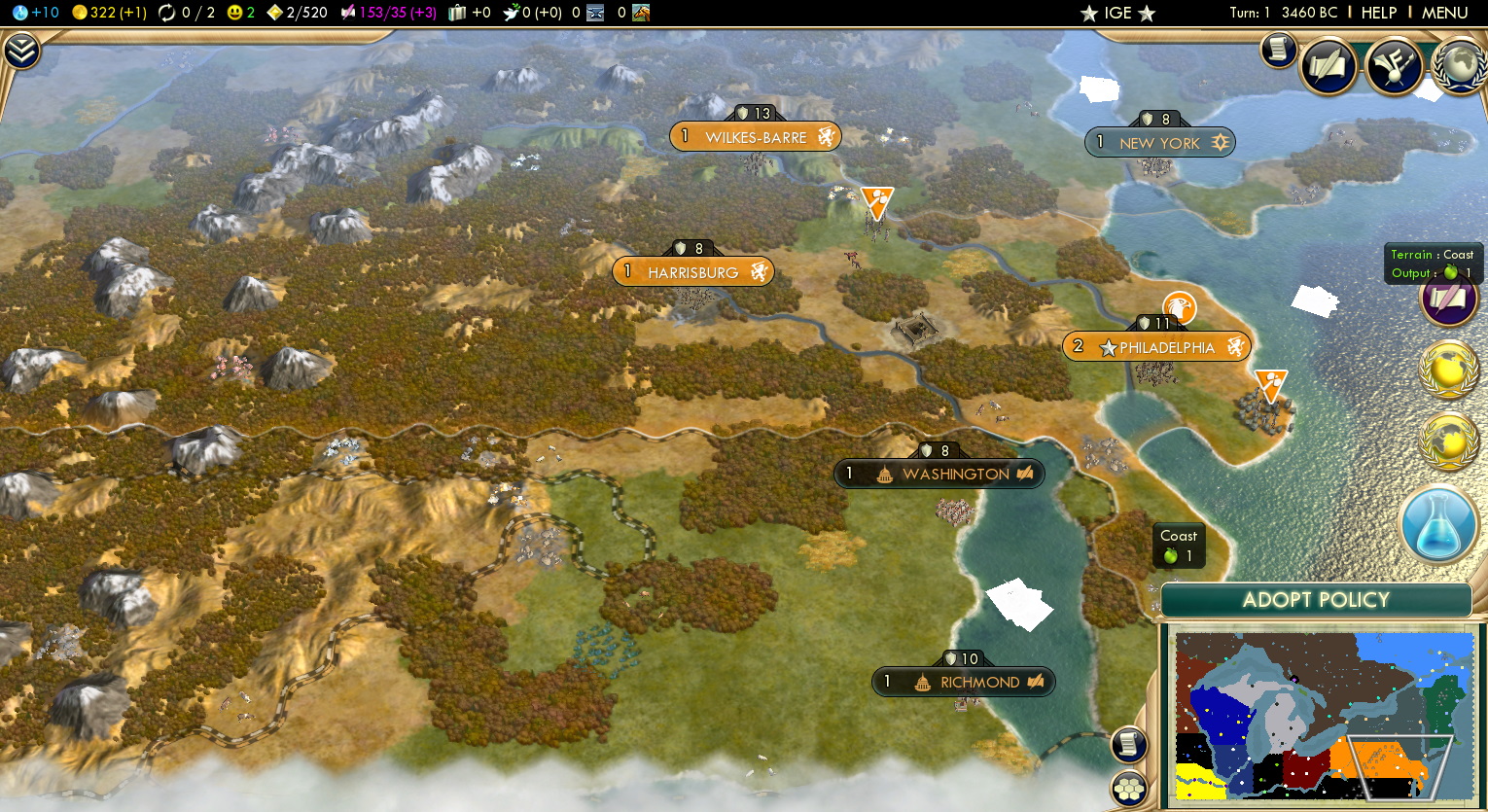 East Coast and Pennsylvania:
 Lake Michigan and Illinois
Wisconsin

Michigan[

Ohio

Second version of map contains only 8 civs, more city states and more space to expand (without state boundaries).
Starting game (installation):
1. Download map file and save it to MAP folder. Usually C:\Users\User\Documents\My Games\Sid Meier's Civilization 5\Maps
2. Start game and select MODS
3. If you want to use some time scenario tick it, otherwise click NEXT
4. Select Custom game, and choose map Great Lakes V1 or V2, don´t forget tick Load scenario
5. Choose leader, difficulty and PLAY
Tested with DLCs (required):
Civilization V, Gods & Kings, Brave New World, Denmark
Created by Civilization V player with more than 1400 hours played.
Before downloading this scenario we strongly recommend try FREE DEMO MAP and read our Terms of use !
Most related maps:
Earth map (true starting location)
Colonization map (true starting location)
Mediterranean European battle