It was the ideal place for the ancestral castle of the Lichtenstein family. High above, directly at the edge of the steeply sloping rocks, about 500m southeast of the later built Lichtenstein Castle, the knights had magnificent control over the narrow valley through which the Bundesstraße 312 winds its way from Lichtenstein up to the Alb today.
Probably built in the second half of the 12th century at the latest, it was last destroyed in the Battle of Reutlingen in 1377.
Prior to this, in the Imperial War against Count Eberhard I of Württemberg, the Reutlingen family destroyed the knight's castles of the Greifensteins in 1311.
In the comparison of 1389, the ruin was returned to the House of Württemberg "as an open house and fief" and as a "ruined property".
In the years 1990 - 1995 the old walls were uncovered and are today a further attraction for Alb tourists and historically interested people.
Source:http://www.gemeinde-lichtenstein.de/,Lde/Startseite/Freizeit+_+Tourismus/Ruine+Alt_Lichtenstein.html
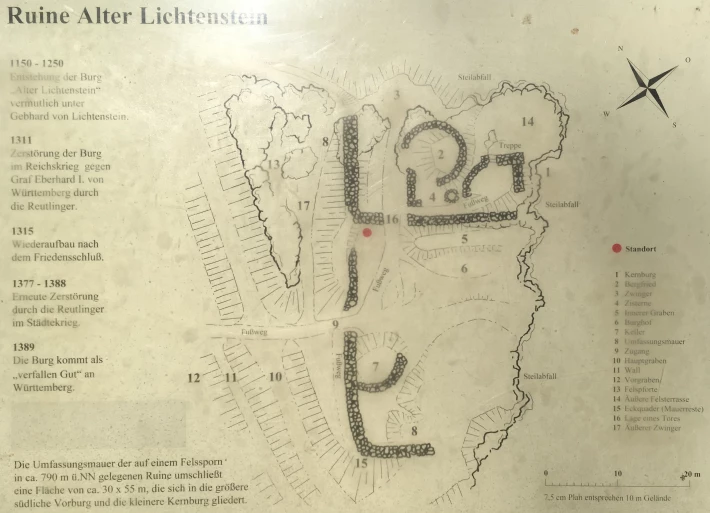
1 Core castle
2 Castle keep
3 Kennels
4 Cistern
5 Inner trench
6 Castle courtyard
7 Cellars
8 Enclosure wall
9 Access
10 Main trench
11 Wall
12 Preliminary trench
13 Rock gate
14 Outer rock terrace
15 Corner blocks (wall remains)
16 Position of a gate
17 Outer kennel
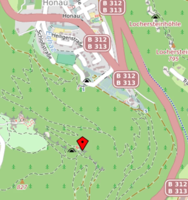
GPS coordinates: 48° 24′ 18″ N, 9° 15′ 45,7″ O |