Introduction
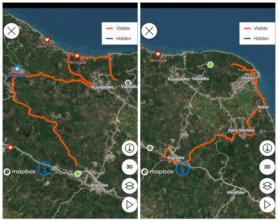
My 3rd Hiking Sundays hike was a participation at "The Fishermen's Route" Hike organised again from the Corfu Hiking and Climbing club on February 2024. "The Fishermen's Route or Road" and in Greek "Η Στράτα των Ψαράδων" is actually a traditional route of the Southern Corfu maybe as old as the Middle Ages and even earlier until the modern days, when the local fishermen were returning at the Port of Petritis with their daily fish and started a tour to the nearby villages of Argirades towards Chlomos selling their fish to the locals for their everyday living as it is showing in the corresponding map.
The Corfu Hiking and Climbing Club
Corfu Hiking and Climbing Club is a well established hiking club in the island of corfu organising hikes and climbs not only in the Corfu countryside but also in the more mountainous Greek mainland especially in the closer regions of Epirus, Macedonia and SW Greece.
As it was translated from its website, its purpose is
...the systematic cultivation and dissemination of all forms of hiking, as well as the protection and promotion of the Greek mountainous area and environment. Some of its individual goals are also the strengthening of every event related to cultural, spiritual and social development and the dissemination and preservation of the folklore tradition of the place. Also, the objectives include its active involvement in matters of protection of the mountainous nature and the environment in general, either autonomously or in collaboration with other relevant Greek and International organizations and associations private or public. It also takes care of the cleaning and maintenance of the paths within the regional unit of Corfu.
Founded in 2017 by a mere 28 founding members, it now consists of more than 250 members participating in weekend hikes in Corfu but also in the Greek mainland according to its annual schedule.
The Trip
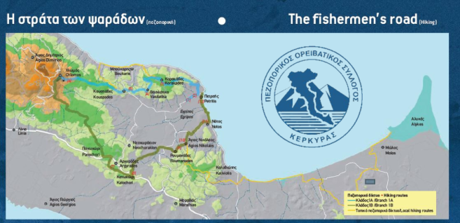
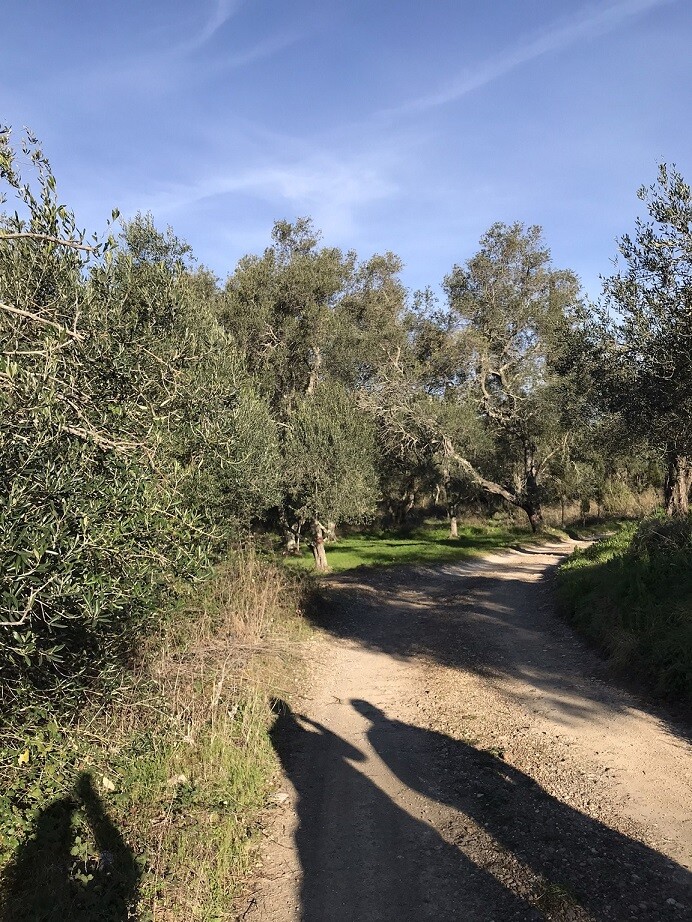
Although the start of the Fishermen's Route is traditionally the port of Petritis, for organisational reasons saving time while driving from Corfu town to the South Corfu, the trip started instead at the outskirts of Argirades village through some magnificent olive groves following the road to Chlomos village which was our first stop.
The Village of Chlomos
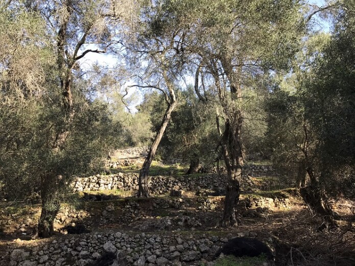
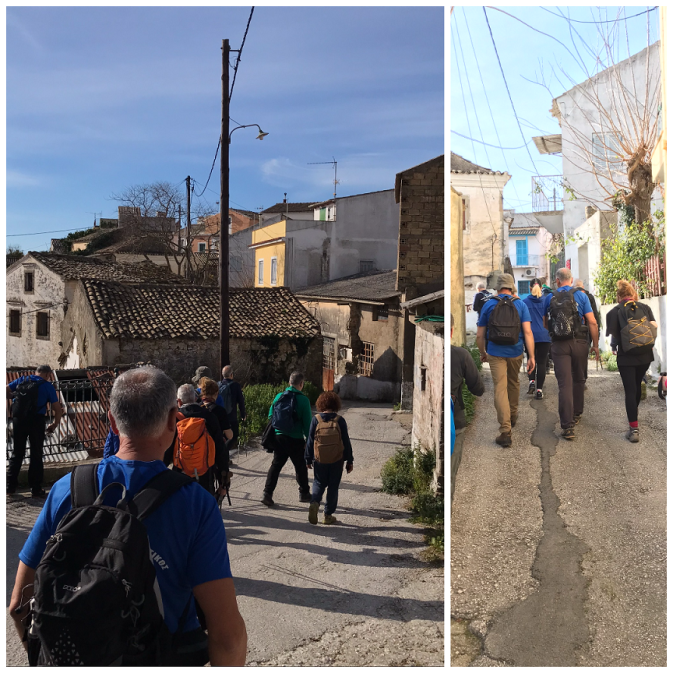
First stop after the Argirades outskirts was the the village of Chlomos that still retains its traditional Corfiot architecture and culture with its narrow paths and old houses since the Venetian Era.
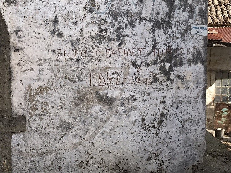
My impression about Chlomos's political stance is that the village as a local community is rather liberal and conservative. This isn't only obvious on the national and local elections results but it is also imprinted on the village's DNA itself. Passing through the narrow paths of the village, someone can notice the remains of the Greek Civil War of late 40s after the World War 2, between the Greek Royalists and the Communist Rebels who tried to overthrow the Greek King and the Official Greek Government and establish a Communist Regime in Greece. The notice says: "ΖΗΤΩ Ο ΒΑΣΙΛΕΥΣ ΓΕΩΡΓΙΟΣ Β! ΕΔΕΣ" which is translated to "LONG LIFE FOR KING GEORGE B'! NDHA (NATIONAL DEMOCRATIC HELLENIC ARMY).
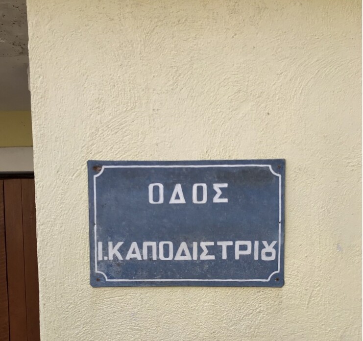
But also a road sign named after Ioannis Kapodistrias. Kapodistrias was the first Greek Governor of Greece after the Greek Revolution of 1821 and he was originated from Corfu. Unfortunately, Kapodistrias was shot dead from the "Greek establishment" (and their foreign protectors) since the Turkish Occupation era who feared that they would lose their established benefits and authorities from the newly developed Greek Independent State of Kapodistrias.
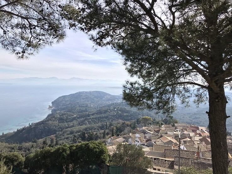
Finally, the view of the Southern Corfu from the top of the hill, where Chlomos village is situated, is magnificent and it host the village's church and cemetery.
The Boukari Bay
After Chlomos Village, we descended to the east coast towards the Boukari Bay.
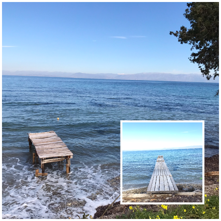
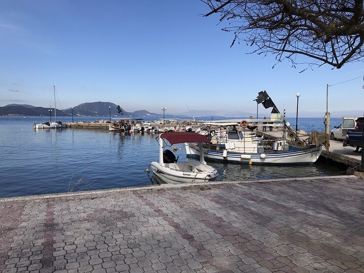
A bay full with traditional fish taverns and restaurants. Even though the hike took place in February, the sea was so tranquil and calm and the weather was sunny and warm perfect for hiking.
 .
.
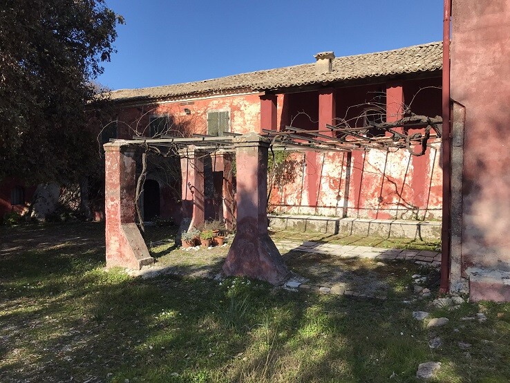
Leaving behind us the Boukari Bay, we started to ascend again and passing from Vasilatika we moved to the abandoned now village of Korakades where we made a short break for a meal. What was depressing to experience in Korakades was the cannibalisation of the traditional old houses with builders removing all the artifacts, marbles, traditional building materials from the abandoned houses to decorate the newly built villas and mansions bought from rich people who would like to have a luxury summer house in Corfu. I won't include any photos from this situation as I find it quite sensitive but I believe it is worth mentioning it. After our meal break, we continued again our trip over the hill towards the original start of the Fishermen's Route, the Fish Village of Petritis. I remember Petritis since my school years when we used to travel from Corfu town there for our summer school trips. Now the kids in primary schools for their summer school trip are taking Ryanair flights to destinations in Northern Europe. Alas, time has changed a lot!
Unfortunately, Petritis, a base for the local fishermen what in Greek is called a "Fish-Village" or "Ψαροχώρι" has nothing to resemble the fishing glory of the past. No fishermen are in the village anymore and most sea-shore properties have become beach bars, restaurants, bangaloos and rooms to let for the tourists. Passing through the sea shore of Petritis, we were found at the small village of Notos which means "South" and Agios Nikolaos and passing through some abandoned today villas and mansions of the past.
The last part of the hike closed the circle after passing through the traditional neighbourhoods of the main village of the area, Argirades. Even though the main road connecting Corfu town with Lefkimmi (the southest part of Corfu) passes from Argirades village cutting the village in 2 pieces, I have never travelled inside the village traditional neighbourhoods. Unfortunately, due to warm weather, my strength and motivation started to deteriorate. I felt I was so close to the finish yet we kept going passing from one path to another and i was so impatient to finish the hike that I hardly took any photographs of the village.
Analytics
Since I have been recoding the whole trip in Strava app, I managed to obtain few analytics of the trip. Unfortunately after passing the Boukari Bay and while ascending to the nearby village of Vasilatika, the GPS connection failed and it was re-established after Korakades on the way to Petriti.
According to STRAVA App analytics, during my hike, I covered a total distance of 5.15 miles + 4.01 miles = 9.16 miles within a total of 3 hours and 54 minutes without including the analytics during the loss of GPS signal.
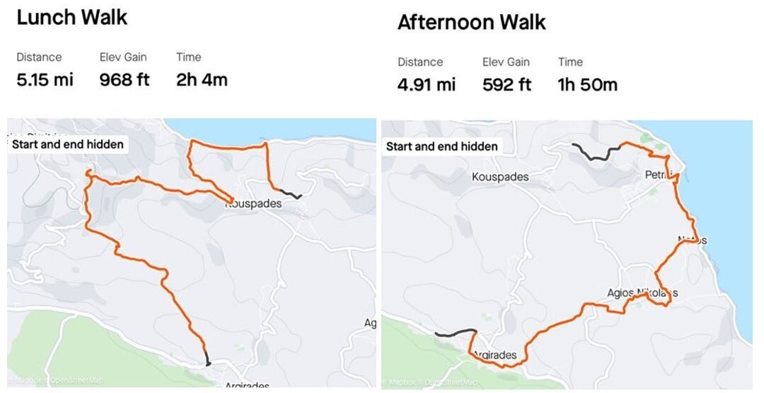
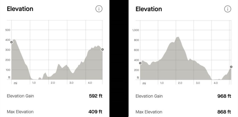
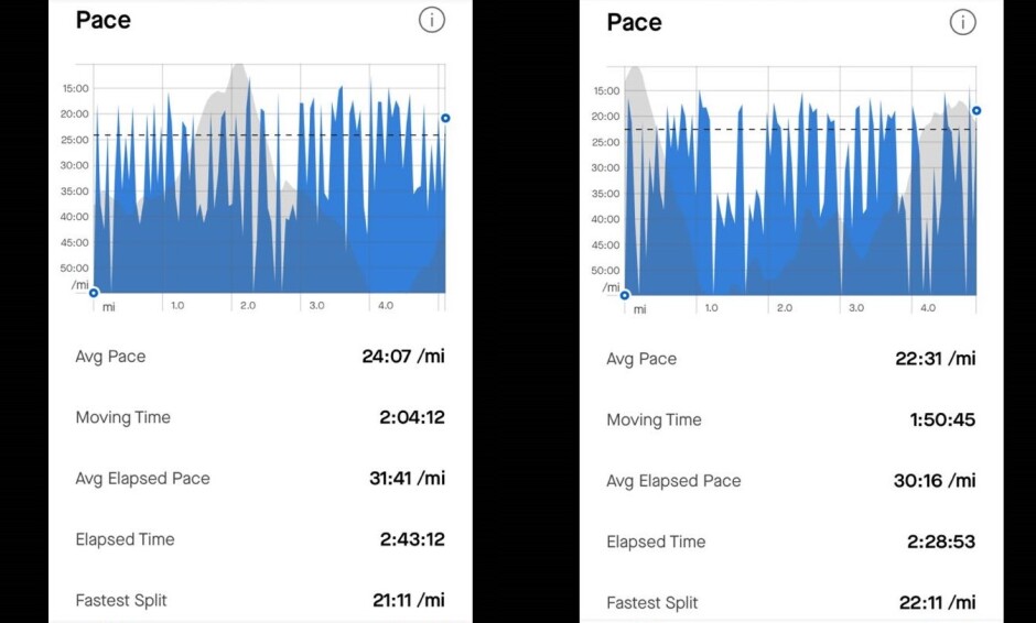
Max elevation elevation was 868 ft while climbing at the top of the hill of Chlomos village and then we went down up to sea level twice. Once at the Boukari Bay and another at the Petritis sea shore. The pace of the hike was also very good with an avg Pace of 24:07 /mi at the first part of the hike even though we had to climb at the top of the Chlomos hill and a bit lower at 22:31 /mi at the second which was actually the most demanding during the closing stage from Agios Nikolaos to Argirades Village. To be honest for a February, it was quite warm as well and that caused a further difficulty and my strength started to deteriorate.
Final Thoughts
Overall it was a great experience in a lovely sunny February hiking Sunday. Although I was born in Corfu town, I had completely no idea of the Fishermen's Road of the "South" and i am grateful for the hike organised by the Corfu Hiking and Climbing Club in the area. Yes it was a bit difficult for me in several stages of the trip although the hiking trip had a mere difficulty grade of 2 but it was an excellent exercise and a break from my usual lazy winter cryptoSundays. With better equipment i.e. hiking boots and batons I could have been more confident to perform better, hell yes I enjoyed it and I was really looking forward to my next Hiking Sunday with the local hiking club.
Publish0x Blockchain stories on [Crypto-monkey] (https://www.publish0x.com/crypto-monkey)
My Censored Blockchain stories on [Read.Cash](https://read.cash/@feax21)
Follow me on [Twitter](https://twitter.com/feax31)
Follow me on [CoinmarketCap Community](https://coinmarketcap.com/community/profile/feax21/)
Follow my [cryptoblog](https://cryptomonkey.weebly.com/)