Good morning/evening
I used to be really up to date on all the DePin projects before they even had the DePin name (Decentralized Physical Infrastructure) partly I guess from being involved with Helium from the early days and being constantly focused on updates and improving set ups and helping others, but then I found Bitcoin and don't focus on so many DePin projects any more but I did see this one and thought it was worth a look at so here is what I have found about the ROVR project.
What is the ROVR Network
ROVR Network is a decentralized physical infrastructure network built on Solana, designed for high definition, realtime 3D mapping. It enables community-driven data collection using LiDAR, RTK‑GNSS, (tech used for positioning and mapping, often in conjunction with each other. LiDAR Light Detection and Ranging uses lasers to measure distances and create detailed 3D maps. RTK-GNSS Real-Time Kinematic Global Navigation Satellite System provides highly accurate positioning data by correcting for errors in standard GNSS signals using a base station) to produce centimeter accurate maps essential for autonomous vehicles, spatial AI, smart cities, and more.
In April 2025, ROVR secured $2.6 million in seed funding, co‑led by Borderless Capital and GEODNET, with additional backing from IoTeX and angel investors.
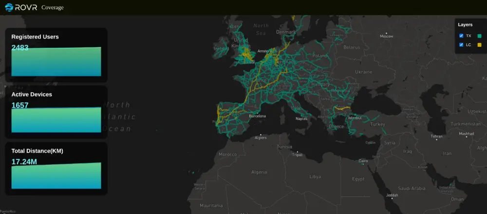
The image below shows users, devices that are active and mapped areas.
-
LiDAR + RTK Positioning:
Delivers street-level, centimeter accuracy by combining laser scanning with high-precision GNSS . -
Inertial Measurement Unit (IMU) Fusion:
Maintains location accuracy even in GPS-denied environments like tunnels.
Rovr Devices
To provide mapping data you will need a device
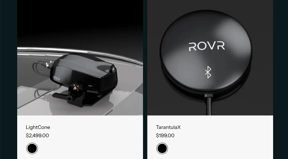
The TarantulaX connects to smartphones via Bluetooth and uses the phone’s camera to capture road imagery, process and classify data, and upload it to earn ROVR tokens.
The LightCone device features a multi-channel LiDAR system (120+ channels, 200-meter range), enabling real-time, precise 3D environmental sensing. It also integrates automotive-grade navigation systems and large-aperture (>130 mm) high-precision measurement antennas. LightCone connects to smartphones via Bluetooth or Wi-Fi, with the phone serving as a control terminal that must remain online for device management. (Seems a bit steep if I am honest and you still need to connect it to a smartphone!)
To qualify for rewards, the vehicle's speed during data collection must remain between 10 km/h and 120 km/h. Any data gathered outside this range will not be eligible. Rewards are based on the number of kilometers of high quality data collected.
High quality data refers to mapped coverage of paved roads featuring clearly visible lane markings and traffic infrastructure. Only roads classified as Level 8 or higher such as highways, urban expressways, ramps, and main city streets are considered valid.
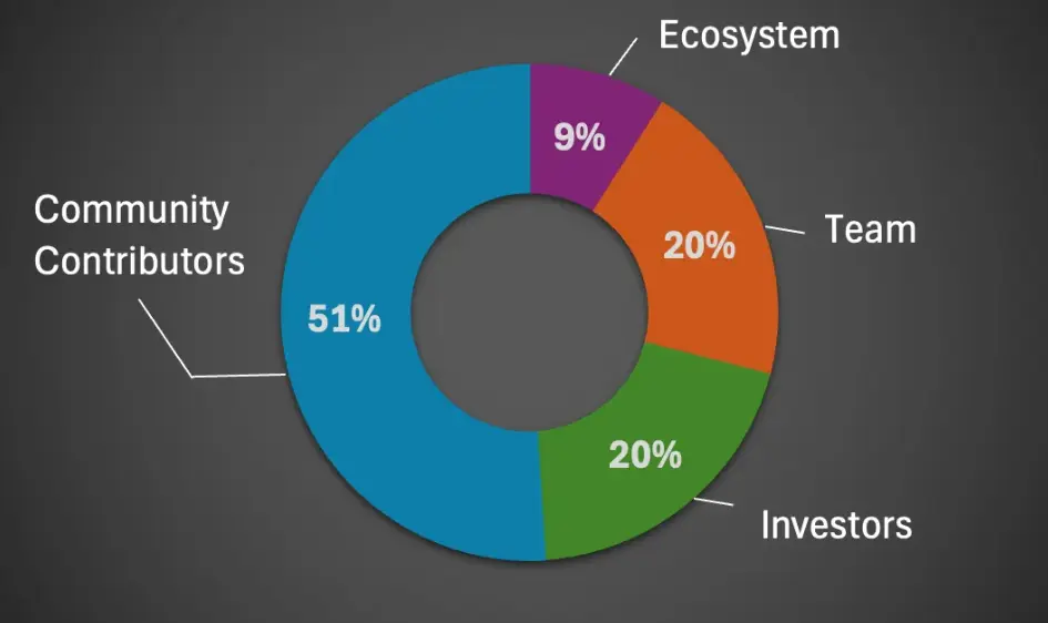
You will receive ROVR tokens and the total number of tokens is capped at 6.6 billion, distributed as follows,
- 51% to miners/mappers
- 20% to investors
- 20% to the team
- 9% to ROVR foundation
Currently miners should be able to earn 1.6 ROVR per KM with the TarantulaX and 16 ROVR per KM with the LightCone device, an anti duplication check also exists, rewards reduce for repeated scans of the same road segment, halving after two visits and dropping sharply on further repeats. This is to try and discourages redundant data collection but also encourage more wider use, but for someone like me who goes to the nearest city every few weeks, yes our supermarket is 40KM away and the local small town regularly, it will be of no use to me, mostly my journeys are to the same places!
There is also a mint and burn mechanism, when a data buyer purchases credits half of the cost (In UDS) is burned and the other half will be used as rewards for miners as well as NFTs and airdrops to boost engagement. There are also plans for miners to be able to run nodes and staking pools eventually.
My thoughts
Ok so I think the devices are a bit expensive especially as you still need to connect them to a smartphone. How many devices will be sold? Then if it is anything like the WXM (weather data miner) you could be waiting a long time for mainnet and rewards, if any. If you only use the same routes regularly then your rewards will become very small.
As with all these DePin projects, if nobody buys your data, you don't make any money, even Helium barely sold any data from its IOT miners.
So although an interesting concept, practically I can't see this one doing much in the long term. What are your thoughts? Do you think this could be the next big thing?
As always, thank you for reading and please feel free to comment.